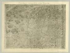
Stik, Allen Young, ed., engraved for "The Cornhill Magazine" Smith, Elder & Co. London, Stanford's Geograph.l Establish.t, Med 4 bikort, and 7100
Litografi, afklippet foroven og forneden, Bikort: North Star Bay, Omenak Fiord og Disko Bay, Kortet viser Grønlands vestkyst, Baffin Bugt og Davis Stræde, samt østkysterne af Ellesmere og Baffin Islands, J. & C. Walker, Sculpt., Hydrographic Office of the Admiralty, and 4100
Koloreret penne- og blyantstegning på pergamentpapir, Med rudenet indtegnet, tegnet af F. Jacobsen. Sommeren 1859, Vaianttitel: Kryolithbruddet Iviktout, and 4100,121
Lystryk, Faksimile i reduceret størrelse af kort oprindelig udgivet i: De i Commentarii del Viaggio in Persia ... et dello scoprimento dell'Isole Frislanda, Eslanda, Engronelanda, Estotilanda et Icaria, fatto sotto il Polo Artico, da due fratelli Zeni, Nicolo et Antonio libro suo. - Venetia 1558. (UAÆS Geogr. 852, - 8°), Med gradnet, by George E. Emery, and 1110
Lystryk i 1/3 størrelse efter original i Staats-Bibliothek i München, Øverst på kortet: Chr.[istiania] Vidensk. Selsk. Forh. 1886 No. 15, Findes også i: Oscar Brenner: Die ächte Karte des Olaus Magnus vom Jahre 1539 nach dem Exemplar der Münchener Staatsbibliothek. - (Forhandlinger i Videnskabs-Selskabet i Christiania ; No. 15), Olavs Magnus Gotus Lincopen, Verlagsanst. Bruckmann, and 1110
Lystryk, Map of the North Sea and lands delineated upon a chart in the 14th century by Antonio Zeno and as printed at Venice in 1558 to accompany the narrative of the Northern Voyages of the brothers Nicolo and Antonio Zeno to Iceland, Greenland, Spitzbergen, Frenz Joseph Land etc. etc., 1380 and after, Med gradnet, George Edwin Emery, Faksimile i reduceret størrelse af kort oprindelig udgivet i: De i Commentarii del Viaggio in Persia ... et dello scoprimento dell'Isole Frislanda, Eslanda, Engronelanda, Estotilanda et Icaria, fatto sotto il Polo Artico, da due fratelli Zeni, Nicolo et Antonio libro suo. - Venetia 1558. (UA ÆS Geogr. 852, - 8°), and 1110
Penne- og blyantstegning på silkepapir. Et hjørne afklippet, [Kopieret af Hinrich Rink], Copie efter "Smithsonian Contributions" Vol XII 1860, by Charles A. Schott, assistent U.S. Coast Survey 1860, and 4100,2
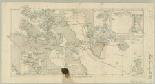
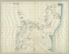
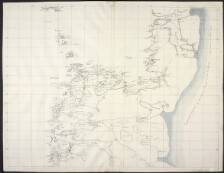
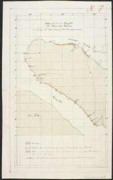
Litografi, 4 bikort: Glaciers of the Highland, The Inland-ice, Territories supposed to have comprised the principal stations of the Ancient Norse Colony: Environs of Godthaab The Westerbygd or Western Settlement og Environs of Julianehaab The Österbygd or Eastern Settlement, Rinks blyantsnoter og udregninger, and 4100
Litografi, Med 4 bikort: Glaciers of the Highland, The Inland-ice, Territories supposed to have comprised the principal stations of the Ancient Norse Colony: Environs of Godthaab The Westerbygd or Western Settlement og: Environs of Julianehaab The Österbygd or Eastern Settlement, and 4100
Rink, Hinrich Johannes (1819-1893) geograf, geolog, grønlandsforsker
Description:
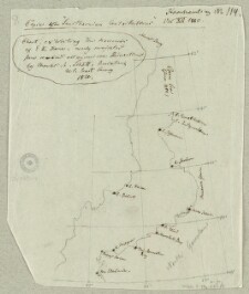
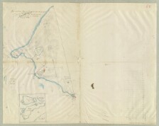
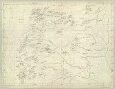
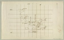
Konturkoloreret penne- og blyantstegning, af H. Rink. August 1848, Bikort: Øerne i området, Titel på bagsiden: Blyantgangene paa Langøen ved Upernavik 1848. Indberetning over Graphitgangene ved Upernavik til Inspektoratet, and 4100,137
Penne- og blyantstegning, Tasaa sanauunga Johannes Poulsen, Bilag: Navneliste og en beskrivelse af kilder foran iisblinken, Kortet er orienteret mod øst, and 4100,123
Rink, Hinrich Johannes (1819-1893) geograf, geolog, grønlandsforsker
Description:
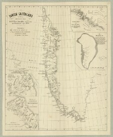
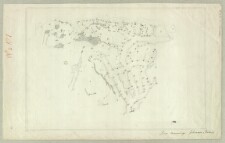
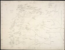
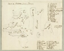
Koloreret penne- og blyantstegning, Beboede og ubeboede steder vinteren 1848-49. Signaturforklaring, Rudenet indtegnet, [Tegnet af Hinrich Rink], and 4100,135
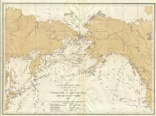
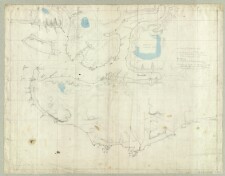
Litografi, Den private Opmaalings lith. Anstalt, Kristiania, paralleltitel: Contour map of the North Ocean, Betegnet: Den Norske Nordhavs-Expedition / A. Mohn Pl. I, and 7100
Rink, Hinrich Johannes (1819-1893) geograf, geolog, grønlandsforsker
Description:
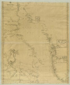
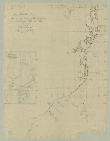
Penne- og blyantstegning på silkepapir. Et hjørne afklippet, Viser: Kyststrækningen fra Kong Dans Halvø i syd til Danmarkshavn i nord, Bikort: Smith Sound: Dr. Hayes Track and discoveries 1860-61 Gradnet indtegnet, Erster band Leipzig 1873, [Kopieret af Hinrich Rink], and 4100,3
Bagside til: Omrids af Arksuks Fjorden, Kryolithbruddet Ivigtok 61° 13m nB. 49° 9m vL., Landtoninger: Indseiling til Arksuksfjord og Arksuk Omanak fra Vestsiden, Med vejledning for sejlads på fjorden på dansk og engelsk. Den engelske klæbet på bagsiden, Foroven på kortet er påklæbet en pennetegning af: Gjennemsnit af Krÿolithbruddet seet Paralel med den nÿe Gjennembrydning, Bilag: Arsut [i.e. Arsuk) Fjord af Daniel Smidt 1862, med en Gejnnemsnit / Hans Pauly. - 1978, For Dhr. Thbd. Weber & Co. efter Peilinger af Daniel Schmidt, Kjøbenhavn Harald Berg. lith Etabl., Harald Berg. lith Etabl., and 4100,121